 |
|
Gust Cloud Image and Weather Data. |
|
Our Site Home Live Local Weather Lightning
Data Archives This Year Weather Images Burton on Trent - Floods Gust Cloud & Data Lightning 26/07/2006 Lightning 12/08/2004 Lightning Images Shelf Cloud & Data Sun Pillar Tornado - 23/08/2004 Space Photographs Comet
Machholz Useful Stuff Storm
Chasing Miscellaneous
|
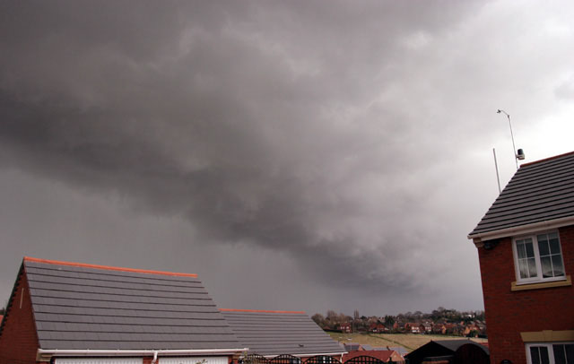
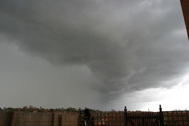
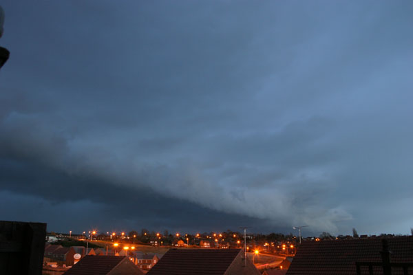
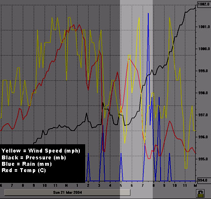
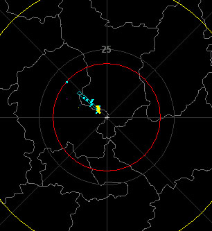
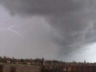
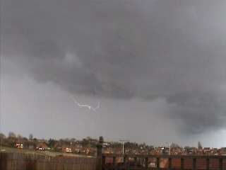
Here is an example on what happened when a gust cloud passed over where I live. I have included three sets of data, the first being images of the cloud, second, the Davis Weather Link data and finally the Boltek Storm Tracker data. Whilst not being dramatic you can clearly see the effect. Images.
Above: The
Gust Cloud seen from three positions. Gust Front.A "Gust Front" is an outflow of cool air from the leading edge of the Cumulonimbus (Cb) Cloud and it is fairly rare to see this unless you get ahead of the storm and are in the right position to experience this front. As the wind prior to the gust front is calm and (say for argument sake) going North as an up draught but the down draughts behind the gust front are going in the direction of the storm and so you get a "rolling" effect, such as your picture. For example, you know that a storm is close, as the wind goes calm briefly, then a cool wind sets in as the dark cloud bank passes overhead. The wind will become strong for a few minutes and then the heavens open into either hail or heavy rain. Davis Weather Link Information.
Boltek Lightning Data
Not soon after the thunder storm started producing 11 strikes per minute at its peak rate.
|


The layout, design and content of this web-site are the copyright material of Steven J Warren.
Copyright 2009 All rights reserved.
DESIGN - www.FlyingBunnyStudio.com
NOT FOR PROTECTION OF LIFE OR PROPERTY
The information here is provided for general interest.