 |
|
Shelf Cloud and Weather Data. |
|
Our Site Home Live Local Weather Lightning
Data Archives This Year Weather Images Burton on Trent - Floods Gust Cloud & Data Lightning 26/07/2006 Lightning 12/08/2004 Lightning Images Shelf Cloud & Data Sun Pillar Tornado - 23/08/2004 Space Photographs Comet
Machholz Useful Stuff Storm
Chasing Miscellaneous
|
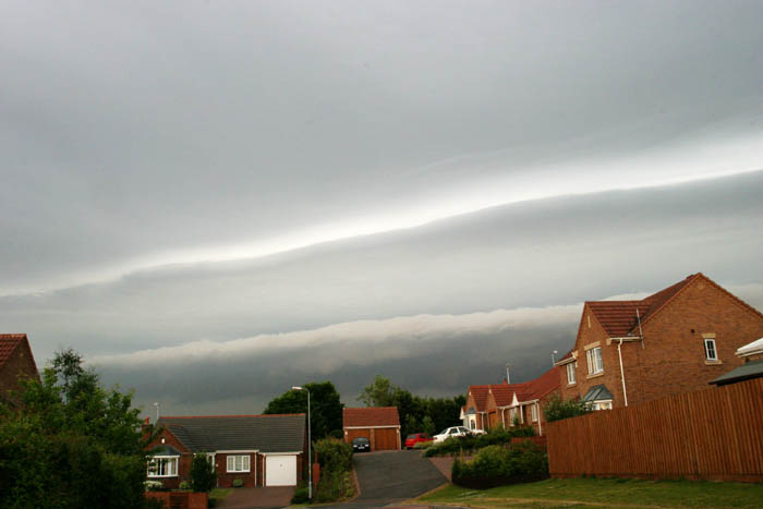
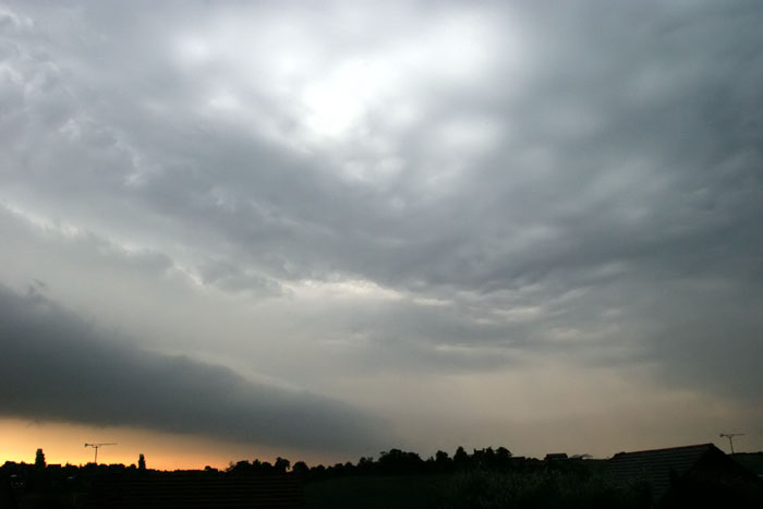
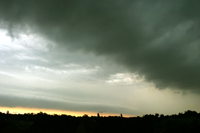
A shelf cloud is a low-level horizontal arcus-type cloud that appears to be wedge-shaped as it approaches. It is usually attached to the thunderstorm base and forms along the gust front. The leading edge of the shelf is often smooth and at times layered or terraced. It is most often seen along the leading edge of an approaching line of thunderstorms, accompanied by gusty straight line winds as it passes overhead and followed by precipitation. It is an extension of the main cloud and the underside is concaved upward, turbulent, boiling, or wind-torn. Shelf clouds are formed when the rain cooled air beneath a thunderstorm sinks, hits the ground, and fans out in all directions. Some of this rain cooled air surges east, lifting and condensing the moist air ahead of the storm, and producing a shelf cloud. While shelf clouds look very menacing, they are not wall clouds or funnel clouds and rarely produce tornadoes.
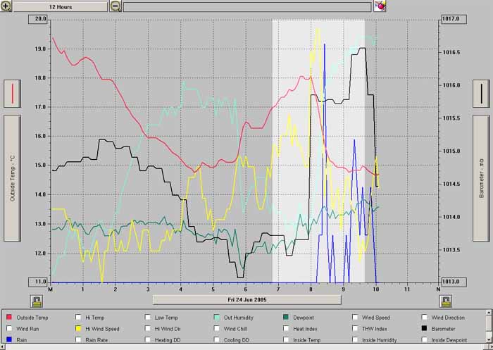
Below is the Davis Weather Station data, before, during and after the event. The light gray area is showing the main changes in the weather data as the shelf cloud approached and passed by.
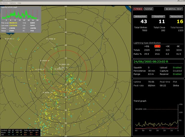
Below is the lightning data for the time the shelf cloud passed.
|

The layout, design and content of this web-site are the copyright material of Steven J Warren.
Copyright 2009 All rights reserved.
DESIGN - www.FlyingBunnyStudio.com
NOT FOR PROTECTION OF LIFE OR PROPERTY
The information here is provided for general interest.